
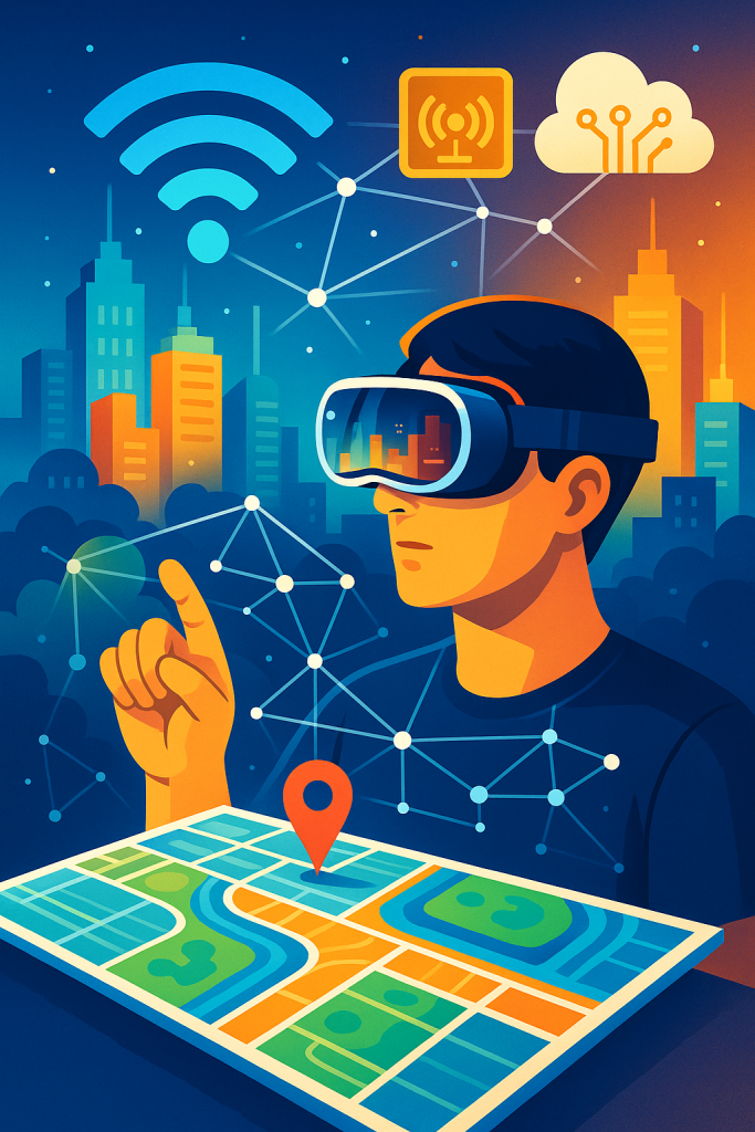
Imagine a world where your everyday surroundings are digitally mapped in real-time, not by satellites alone, but through the collective power of wearable devices and IoT sensors. In 2026, this isn't science fiction—it's the reality shaped by advancements in extended reality (XR). A standout development is highlighted in The 2026 Virtual Reality and Spatial Computing Paradigm, which delves into how sensor arrays in XR devices are fusing data for immersive physical-digital interactions. This paradigm emphasizes spatial computing, where devices like the Apple Vision Pro and Meta Quest 3 use multiple cameras and sensors to achieve precise environmental mapping, enabling applications from enterprise training to collaborative design. According to insights from Forbes on physical AI in XR, these technologies are making XR relevant by addressing real-world navigation and object tracking. But what does this mean for crowdsourced geospatial data? It opens doors to fusing IoT sensors across networks, allowing users to contribute to shared maps of physical environments. In this post, we'll explore the selected XR item, gain insights into XR's role in sensor fusion, identify specific problems in geospatial data acquisition, and unveil XR-driven solutions. Get ready to discover how 2026's XR innovations are blending our physical and digital worlds for unprecedented accuracy and collaboration.
Table of Contents
The 2026 Spatial Computing Paradigm
In 2026, spatial computing has evolved into a cornerstone of XR technologies, integrating virtual reality (VR), mixed reality (MR), augmented reality (AR), and smart eyewear. As detailed in the primary source, this paradigm focuses on OS maturity, environmental mapping fidelity, and deployment scalability. Devices are equipped with advanced sensor arrays—for instance, the Apple Vision Pro boasts 12 cameras, 5 sensors, and 6 microphones for intuitive interfaces driven by eyes, hands, and voice.
Other notable examples include the Samsung Galaxy XR with six world-facing cameras for 6DoF tracking and a depth sensor, and the Meta Quest 3 with high-fidelity color passthrough for accurate room mapping. These features allow virtual objects to interact realistically with physical environments, such as being occluded by furniture.
"The sensory stack of the Apple Vision Pro is unmatched... utilizing 12 cameras, five sensors, and six microphones to provide an intuitive interface driven entirely by eyes, hands, and voice."
This shift emphasizes low-latency tracking and multimodal AI integrations, paving the way for applications in manufacturing, healthcare, and beyond.
XR Insights on Sensor Fusion
Sensor fusion in XR devices combines data from multiple sources to create a cohesive understanding of physical environments. In 2026, this involves fusing camera inputs, depth sensors, and microphones for real-time geospatial mapping. Insights from secondary sources highlight how physical AI enhances this, with AR developers leveraging spatial mapping for object tracking and environment reconstruction.
- 6DoF inside-out tracking enables untethered movement and precise positioning.
- Depth sensing allows for accurate occlusion and interaction between virtual and physical elements.
- Integration with AI provides context-aware guidance, fusing IoT data for enhanced experiences.
Stats show impressive specs: Apple Vision Pro achieves 12ms latency, while Xreal One Pro hits 3ms with 6DoF anchoring. This fusion is crucial for crowdsourced data, where multiple users' devices contribute to shared geospatial datasets.
| Device | Key Sensors | Latency |
|---|---|---|
| Apple Vision Pro | 12 cameras, 5 sensors | 12ms |
| Meta Quest 3 | Depth sensor, color passthrough | N/A |
| Samsung Galaxy XR | 6 cameras, depth sensor | Low |
Challenges in Geospatial Data Acquisition
Traditional geospatial data acquisition relies on satellites and dedicated surveys, but it faces issues like high costs, limited real-time updates, and privacy concerns in crowdsourced models. In physical environments, fusing IoT sensors adds complexity due to data silos, varying accuracy, and interoperability problems.
For instance, individual devices may capture accurate local data, but aggregating crowdsourced inputs requires robust validation to avoid errors. Additionally, urban areas with dense IoT networks suffer from signal interference, while rural zones lack sufficient contributors.
- Data privacy: Ensuring anonymous contributions without compromising user security.
- Accuracy inconsistencies: Varying sensor qualities across devices.
- Scalability: Handling massive data volumes from global IoT fusion.
These challenges hinder applications like smart city planning and disaster response, where timely, fused geospatial data is critical.
XR Solutions for IoT Integration
XR in 2026 offers solutions by leveraging sensor fusion for crowdsourced geospatial data. Devices like those in the spatial computing paradigm enable users to contribute real-time mappings via integrated IoT networks, creating dynamic, shared environments.
Through AR overlays, users can visualize and validate fused data, improving accuracy. For example, Meta Ray-Ban Display's camera and AI fusion allows real-time translations and guidance, extendable to geospatial contributions.
Key benefits include: Enhanced precision through multi-device sensor aggregation, reduced costs via crowdsourcing, and improved accessibility for non-experts.
As noted in policy priorities from XRA, XR merges digital and physical realms, supporting foundational tech for such integrations.
This solves data silos by standardizing fusion protocols, enabling applications in navigation, environmental monitoring, and urban planning.
Broader Implications and Future Trends
Beyond immediate solutions, 2026 XR sensor fusion could transform industries. In healthcare, fused geospatial data aids in real-time patient monitoring via IoT wearables. Transportation benefits from crowdsourced traffic maps enhanced by AR navigation.
Future trends point to AI-driven predictive mapping, where XR devices anticipate environmental changes based on fused data. However, ethical considerations like data ownership must be addressed.
Insights from CES 2026 honorees showcase limitless screens blending physical and virtual worlds.
Call to Action
Ready to dive into this XR revolution? Explore the paradigm and consider integrating sensor fusion in your projects. Support innovations by engaging with communities and adopting XR tools for geospatial contributions.
In conclusion, the 2026 spatial computing paradigm, with its emphasis on sensor fusion, is bridging gaps in crowdsourced geospatial data acquisition and IoT integration. From addressing data challenges to enabling real-time solutions, XR is reshaping how we interact with physical environments. Broader implications extend to smarter cities and efficient industries, promising a future where digital and physical seamlessly converge. As we move forward, embracing these technologies can drive innovation and collaboration. To support this XR item, visit the original article and explore how you can contribute to or benefit from these advancements. Let's collectively build a more connected world.
Key Takeaways
- 2026 XR devices use advanced sensor arrays for precise environmental mapping and fusion.
- Sensor fusion enables crowdsourced geospatial data, solving traditional acquisition challenges.
- Devices like Apple Vision Pro and Meta Quest 3 exemplify low-latency tracking for immersive experiences.
- XR solutions integrate IoT for real-time, shared physical-digital environments.
- Broader impacts include enhanced applications in healthcare, transportation, and urban planning.
- Ethical considerations like data privacy are crucial for sustainable adoption.
- Support XR innovations by exploring sources and adopting fusion technologies.
- Future trends lean toward AI-predictive mapping in XR ecosystems.
What are your thoughts? Comment below!
Generated by AI. Reviewed by Human.