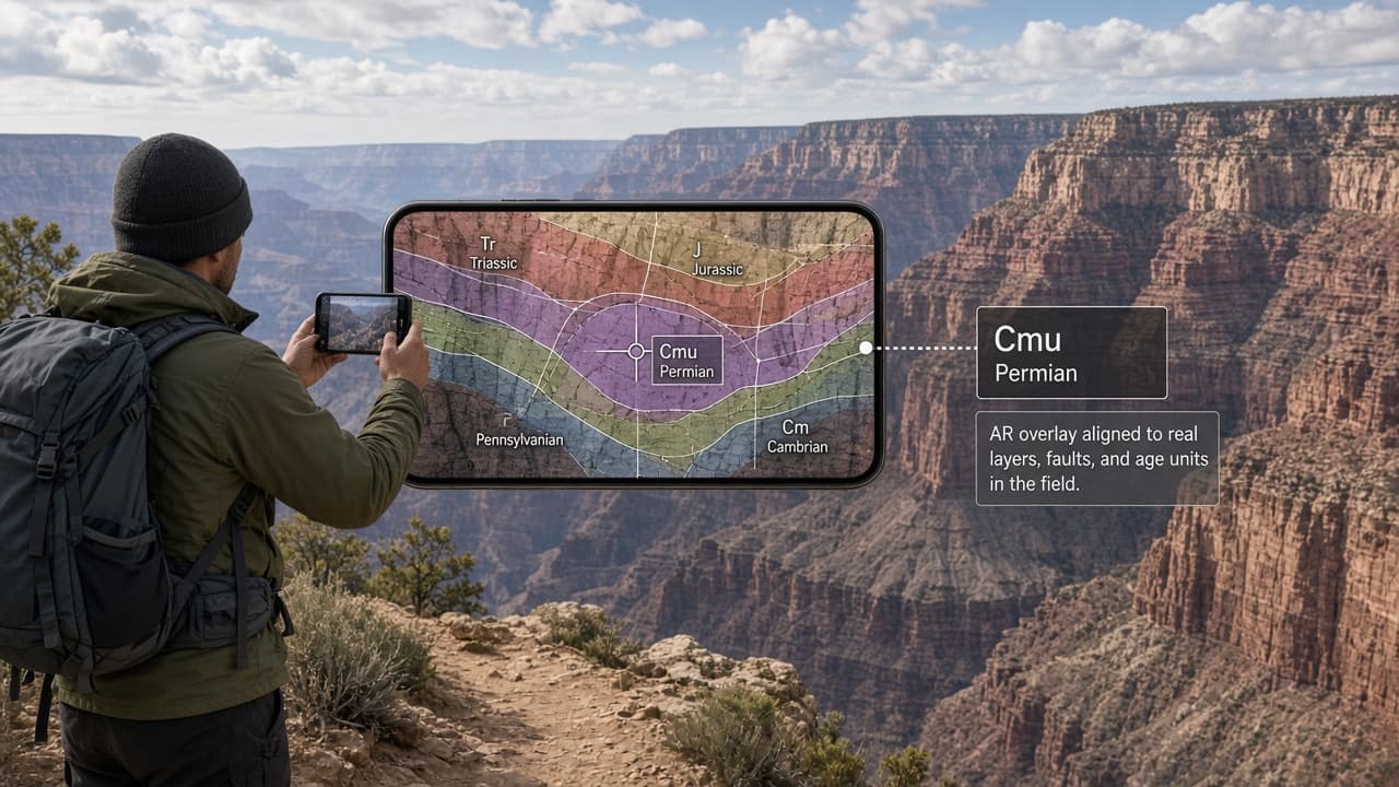
You’re on a trail or roadside pullout, looking at a ridge or canyon wall. The rock looks different from what you passed five minutes ago, and you wonder what it is, how old it is, and why the layers tilt that way. Most people reach for a paper map or a phone photo, then struggle to match the flat drawing to the three-dimensional scene in front of them.
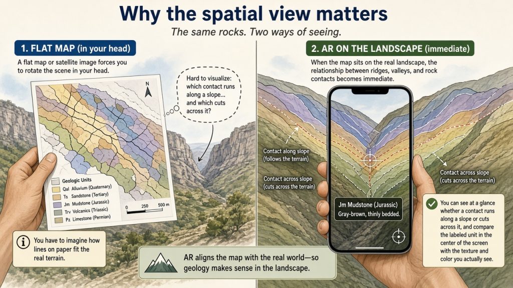
Outcrop is a free mobile app that places a geologic map directly over the live camera view. Hold your phone up and the rock units, faults, and ages appear aligned with the actual terrain. The app identifies the rock under the crosshairs, shows its place in Earth’s timeline, and works offline once the map data for your region is downloaded.
Why the spatial view matters
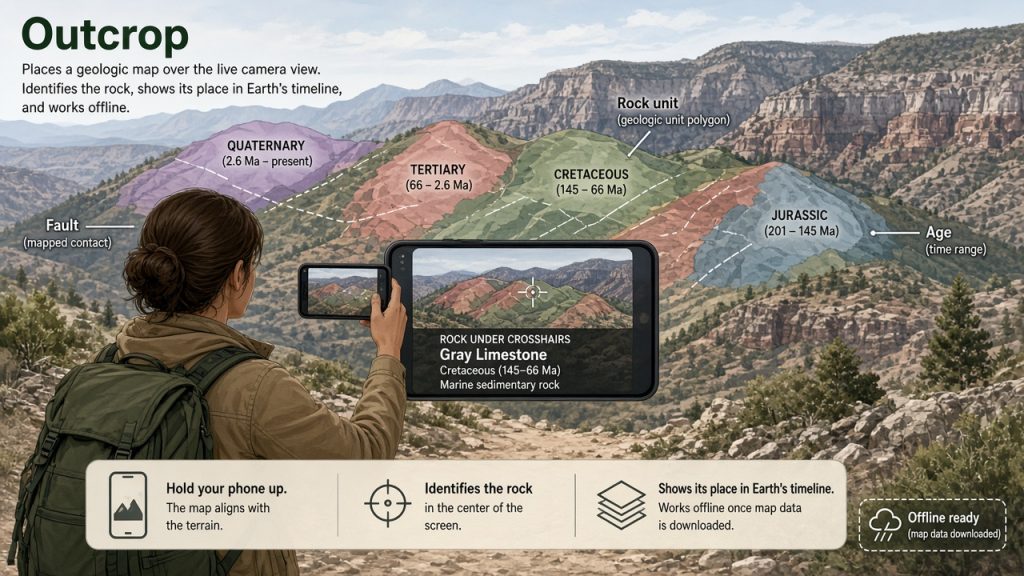
A flat map or satellite image forces you to rotate the scene in your head. When the map sits on the real landscape, the relationship between ridges, valleys, and rock contacts becomes immediate. You can see at a glance whether a contact runs along a slope or cuts across it, and you can compare the labeled unit in the center of the screen with the texture and color you actually see.
Getting started with Outcrop
Visit the official site at outcrop.rocks or download directly from the Google Play Store or App Store. Check current device requirements and pricing on those pages. The app is free with no account required and supports offline use after downloading map data for your area.
Try this first
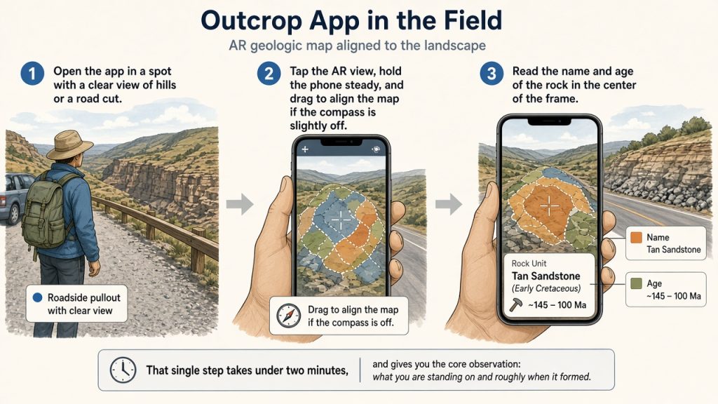
Open the app in a spot with a clear view of hills or a road cut. Tap the AR view, hold the phone steady, and drag to align the map if the compass is slightly off. Read the name and age of the rock in the center of the frame. That single step takes under two minutes and gives you the core observation: what you are standing on and roughly when it formed.
Estimated effort for a first session: 10–20 minutes.
One coherent route
- Choose a location with visible bedrock or distinct landforms (a canyon rim, quarry overlook, or mountain pass works well).
- Open Outcrop and grant camera and location access. The bottom bar shows the rock unit beneath you, its age range, and the broader region.
- Switch to the AR camera view. Raise the phone to eye level and point it at the landscape. The geologic map drapes over the terrain model.
- Center the crosshairs on a feature you want to understand. The app names the unit and offers a short description of its composition and formation.
- Optional: tap the timeline to see where that rock sat on the globe when it formed. The view updates to an ancient continent configuration.
A common stumbling point is compass drift in areas with magnetic rock or near power lines. Drag the map with one finger to nudge it into visual alignment; the underlying data stays accurate.
Accessibility note
If holding a phone steady is difficult, rest it on a rock or use a small tripod. The app also works in a non-AR map mode that still shows your location on the geologic layer and lets you explore by tapping.
Natural endpoint
After 10–15 minutes you will have named at least one rock unit in front of you, placed it in geologic time, and noticed how its mapped boundaries relate to the visible topography. Close the app and look again with unaided eyes; many people report that the shapes now “make sense” in a way they did not before.
Reflection prompt: Which contact or color change on the AR overlay surprised you most when you compared it with what you could see without the phone?
Next step in the same activity
Return to the same viewpoint at a different time of day or after rain. Re-open the AR view and note whether shadows or surface moisture change which contacts stand out. The map stays the same; only your observation of the real rock changes.
Ready to explore?
Try Outcrop on your next outing and see the landscape in a new way. Share this article with a friend, pick a time that works for both of you, and bring one simple question about the rocks you expect to see.