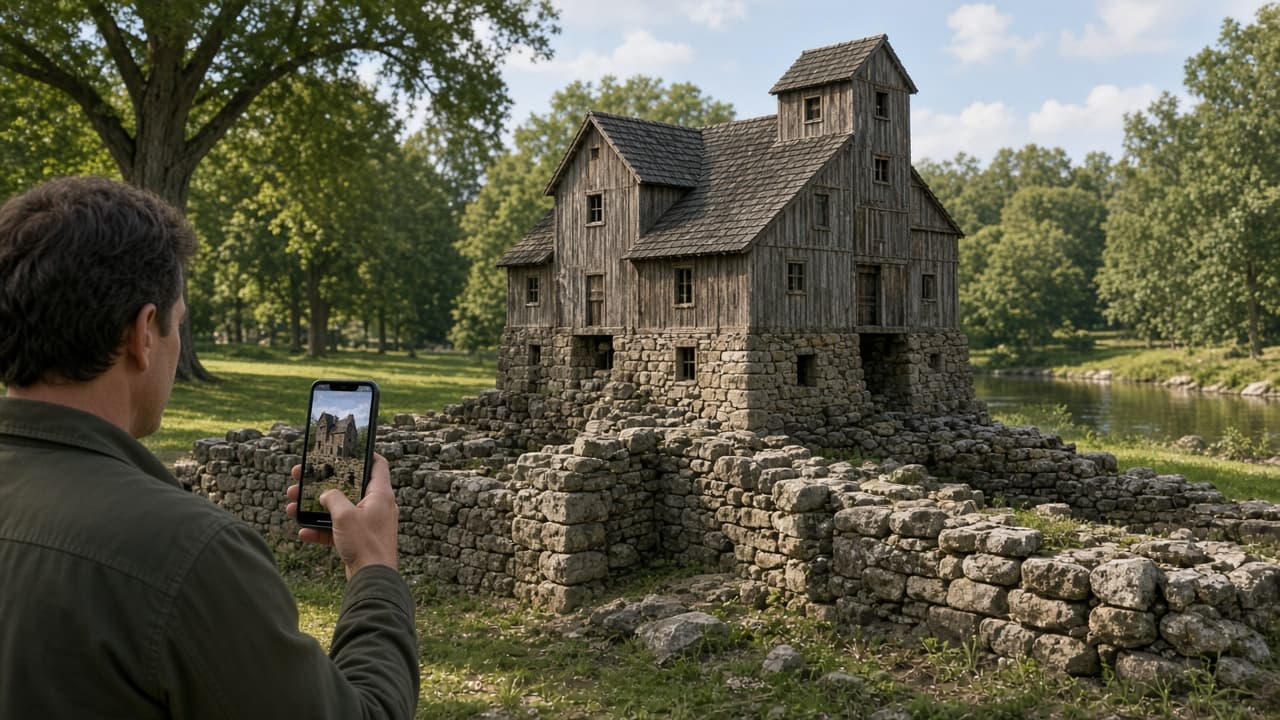
You stand at the low stone foundation of an old mill or fort in a nearby park or historic district. The grass and scattered blocks give little sense of height, rooms, or daily life. An ordinary map or plaque explains dates and names, yet the scale stays flat on paper. One modest step turns the visit into a spatial conversation with the site itself: download a location-aware AR app that anchors a researched reconstruction directly onto the real remains, then walk the outlines as they once stood.
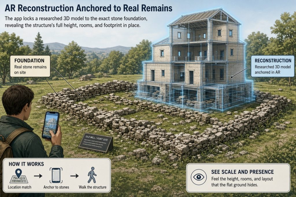
This plan suits anyone who already walks heritage sites for pleasure and wants one clearer picture of proportion and presence without leaving the location. The XR action is simple—point your phone at the foundation; the app places a three-dimensional model that stays fixed as you circle it. The modest takeaway is noticing how much larger or more complex the original structure felt in its actual setting.
Launch the AR Reconstruction at Your Location
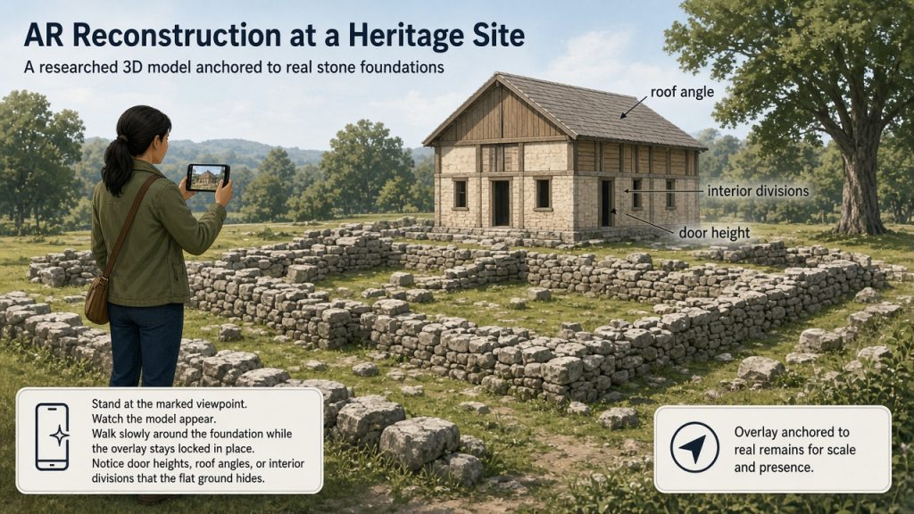
At the site, open the free TimeLens app on a recent smartphone that supports ARCore or ARKit. Select the matching location if available, or a similar reconstruction feature in another heritage AR app such as Eureka3D XR. Stand at the marked viewpoint, grant camera access, and watch the model appear. Walk slowly around the foundation while the overlay stays locked in place. Spend five to ten minutes noticing door heights, roof angles, or interior divisions that the flat ground hides.
Estimated effort: ten to twenty minutes on site after a two-minute download and one short scan. No headset or paid ticket required for the basic overlay. Check current device requirements and pricing on the official store page before downloading.
Why the Spatial View Adds Something Ordinary Methods Miss
A printed plan or screen video shows the same reconstruction, yet it never matches the real light, ground slope, or your own changing viewpoint. Anchoring the model to the actual stones lets you test distances with your own steps and see how the building would have blocked or framed the surrounding landscape. That direct comparison is the mechanism that turns abstract history into an immediate observation.
Follow One Coherent Route Through the Site
Choose a documented heritage location that already appears in the app’s coverage—examples include lower Manhattan New Amsterdam spots, sites in Athens, Rome, or Jerusalem. Confirm the site is publicly accessible and that the app lists it before you travel. At the foundation or marker, launch the app, choose the reconstruction, and allow location and camera permissions. The model loads over the live camera feed. Move at normal walking speed; the overlay updates with your position because the app uses device sensors and image recognition rather than manual placement.
A common stumbling point is poor lighting or moving too quickly, which can cause the model to drift. Pause, step back to the initial scan point, and let the app re-lock the position. If the overlay still wobbles, switch to the app’s 360° or photo-based view of the same reconstruction for a stable reference before returning to live AR.
Adapt if Tracking Feels Unreliable
If phone AR tracking feels unreliable at your chosen spot, stay on the same activity by using the app’s static 3-D viewer or audio guide while standing in the same place. The core comparison—imagining the full height against the real foundation—remains possible without perfect tracking.
Keep a Small Reusable Record
Before you leave, note three quick observations on your phone: one distance that surprised you, one feature now visible only because of the overlay, and one question the model raised about daily use of the building. These three lines turn the visit into a portable record you can compare with the next site.
End the Session and Plan Your Next Visit
The session ends when you have walked the full perimeter once or twice and formed those three notes. Reflection is brief: what felt different once the model was anchored in the real light and ground, and what part of the experience still relied on imagination. A proportionate next step is repeating the same overlay process at a second foundation within the same district or at another listed site on a later visit.
Try this activity at a familiar local site, share the article with a friend, choose a convenient time, and bring one simple idea to test what the overlay reveals.
Source: TimeLens app documentation and coverage list at timelens.eu (accessed November 2026). Additional AR tour capabilities verified through Eureka3D XR listing on Google Play (updated July 2026).